|
I've Got Something to Say
|
| Ride Stats |
|
Time: 03:34:35
|
Distance:
49.38 miles
|
Max Speed:
35.60 mph
|
|
Avg Speed:
13.80 mph
|
Altitude Gain:
0 ft
|
Route:
4 Ferries
|
|
Weight:
0
|
Category: general: leisure -
group
|
Terrain: Road: Hills
|
|
Bike: Fuji Roubaix RC Road
|
Club: None |
| Weather Conditions: upper 70's to upper 90's, mayby even 100 - heat index was over 100
clear skies and a light breeze once in awhile |
|

|
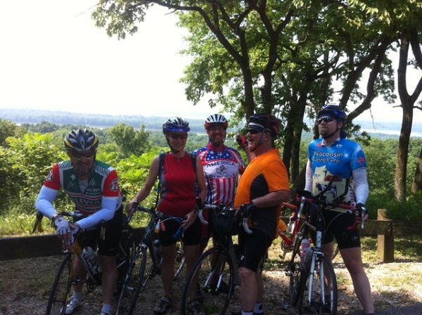
Our starting point was moved from Mid Rivers & I-70 to Mueller Soccer Park off Elm & 370, because Hwy B on the west end was closed. Little did we know, until we got to Hwy B that there was water over the road coming from the east, too. We were wanting to get to the Golden Eagle Ferry, to cross the Mississippi River into Calhoun County, IL, so we kept rolling through the 2-4 inches of water over the road. One almost funny part, Jeff was out front of the other 5 of us, through the first section of water and starting the second as we were just getting ready to start the first, when an SUV came rolling by us through the water causing some major water spray. Well, the driver was kind enough to wait for Jeff to finish the second section before he started, as not to drench Jeff with the wash.
There was also some water over the road that leads up to the ferry loading area - the loading area itself was under water other than just enough room for us to stand & wait, good thing there was only one vehicle waiting with us. Once landing in Calhoun County, we made our way across the peninsula to catch the Brussels Ferry across the Illinois River into Jersey County, IL where we soon made our way to Pere Marquette State Park where we enjoyed a brunch buffet.
As we ate, it was discussed that we would take the back way out of the park, which would require a little bit of a climb - Paul was guessing it was 2 to 2.5 miles of climbing - and it was. There was even a part where we went down hill for a ways, thinking the climbing was over, but noooo, there were still two more climbing sections left before flying down Grafton Hallow Rd to Hwy 100 (the river road). We jaunted south to Grafton before realizing the ferry was actually the other way, so we stopped for a few minutes at The Loading Dock for a beverage and to refill our bottles.
Once returning to the Brussel's Ferry and returning to Calhoun County, we noticed that the water that was over the low, flat 3+ mile stretch of road to/from the ferry loading area on the Calhoun County side no longer had water over the road. We stopped, again, at the Golden Eagle Country Store before doing the last few climbs and ultimatly the descent down to the Mississippi River and the ferry. We just missed catching the ferry back to St Charles County, so we stepped into Kinder's where there slogan is 'on and sometimes in the Mississippi River' - today it is pretty close to being 'in'.
After crossing the Mississippi, the water was noticably down but still over the road at the ferry landing. As the others rode through the water, Jen walked, and I thought it would be about as good to walk too - that's how my shoes got soaking wet. It was just about 5 miles from there to our cars, and the water was no longer over Hwy B like we encountered on the way out. And as hot as it was (around 100) the miles were to short to allow the shoes time to dry out, and I was ready to get out of the sun & heat.
Overall, though, it was a good ride and just long enough on a day like today.
0 member views | 10381 total views
report problem |
|
|
|
|

